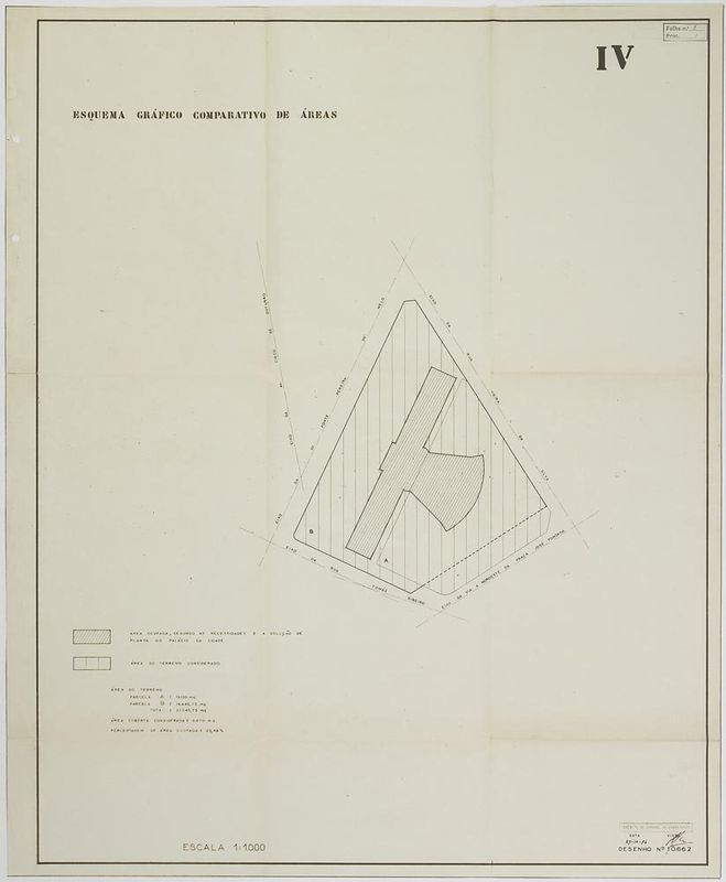

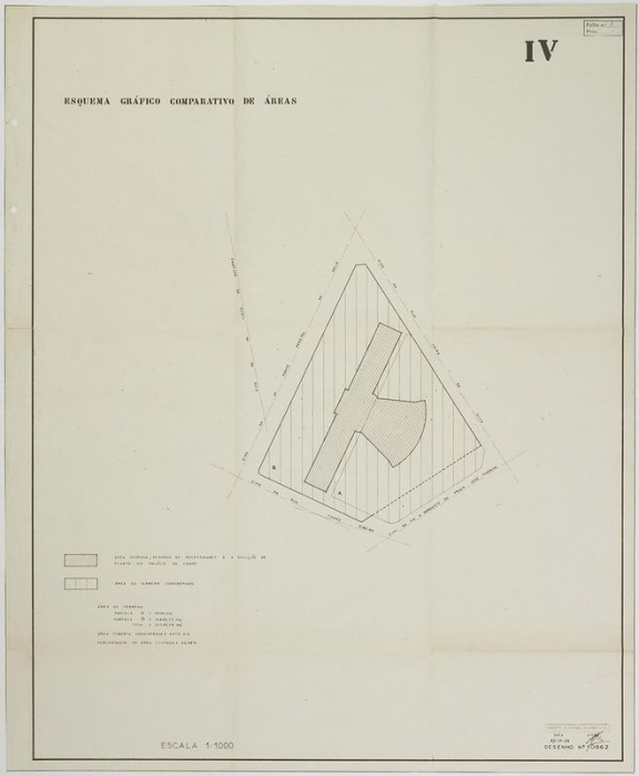
Comparative Chart of Areas I Comparative plans of possible locations for the Foundation’s Headquarters and Museum
Study on the plot of the old Slaughterhouse of Lisbon, next to the Avenida Fontes Pereira de Melo, using the City Museum, designed by the architect Alfredo Keil do Amaral, as a model of cultural infrastructure.
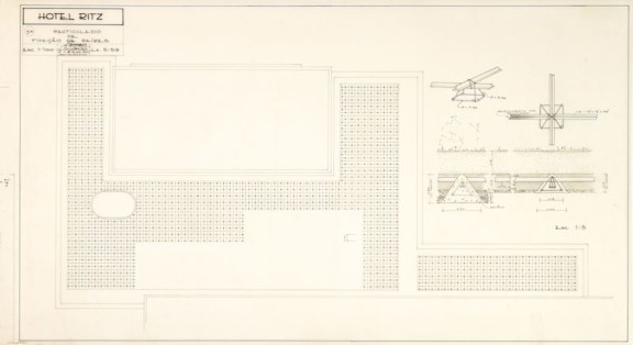
This blueprint is part of a set [i] of drawings included in the Memorandum on the Location of the Calouste Gulbenkian Foundation’s Headquarters Facilities and Museum of which aimed to show how the different areas and locations influenced the relations between the various buildings (museum, auditorium) and between these and the space in which they would be built, as well as the relation of the whole with the city. Points assessed in the five hypotheses under study were accessibility, proximity to structural roads, culturally dynamic neighbourhoods, integration with future urban priorities, opportunities offered by the terrain to define a framing area, protection, isolation, parking and the possibility of surface construction, especially for the museum facilities.
[i] Comparative Chart of Areas I Comparative plans of possible locations for the Foundation’s Headquarters and Museum
- Production date: 1957
- Designers (main authors): GUIMARÃES, Luís de
- Project phase: A preparação do parque e as instalações provisórias
- Temporal coverage: 1957
- Type of data: Image
- Extension format: 1 desenho
- Media format: jpg
- Keywords: calculation, technical design