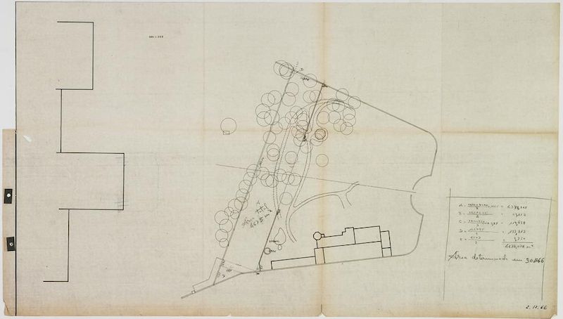
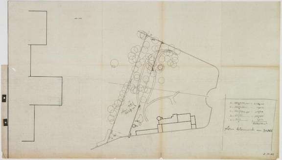
Area Calculation – Study on the Park’s Expansion
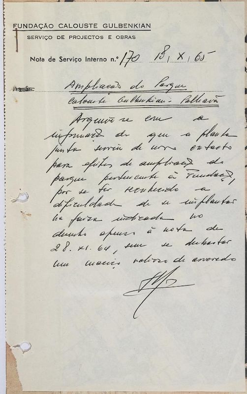
This document is included in a set of documents concerning the purchase acquisition process, of a plot of land of the Santa Gertrudes Park [i], from Vasco Vilalva.
[i] Expansion of Calouste Gulbenkian Park
- Production date: 1966
- Designers (main authors): TELLES, Gonçalo Pereira Ribeiro
- Project phase: Revisão de 1966
- Temporal coverage: 1966
- Type of data: Image
- Extension format: 1 desenho
- Media format: jpg
- Keywords: calculation, expansion, sketch
Related documents
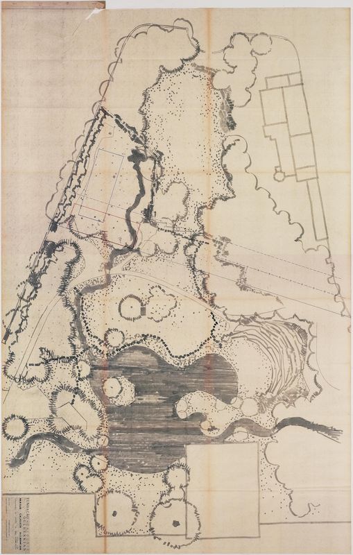
Blueprint of Santa Gertrudes Park, where the new area to be acquired from the Count of Vill’Alva is registered
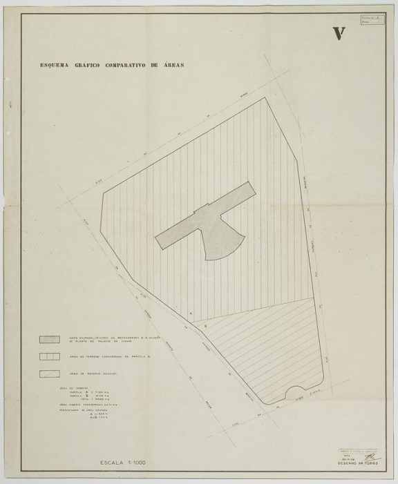
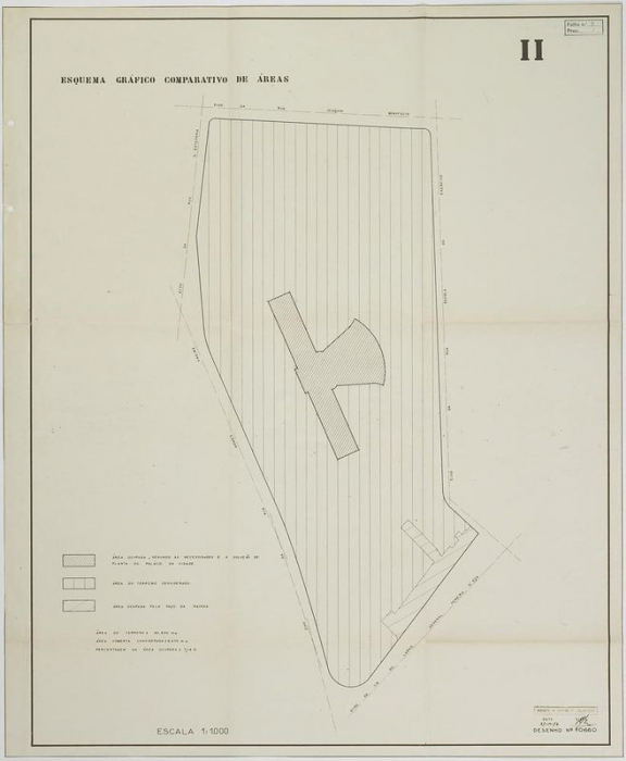
Comparative Chart of Areas I Comparative plans of possible locations for the Foundation’s Headquarters and Museum
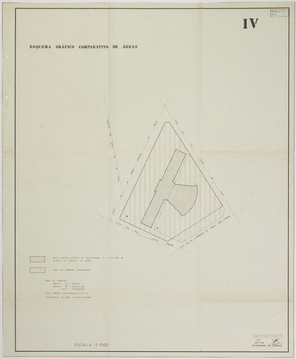
Comparative Chart of Areas I Comparative plans of possible locations for the Foundation’s Headquarters and Museum
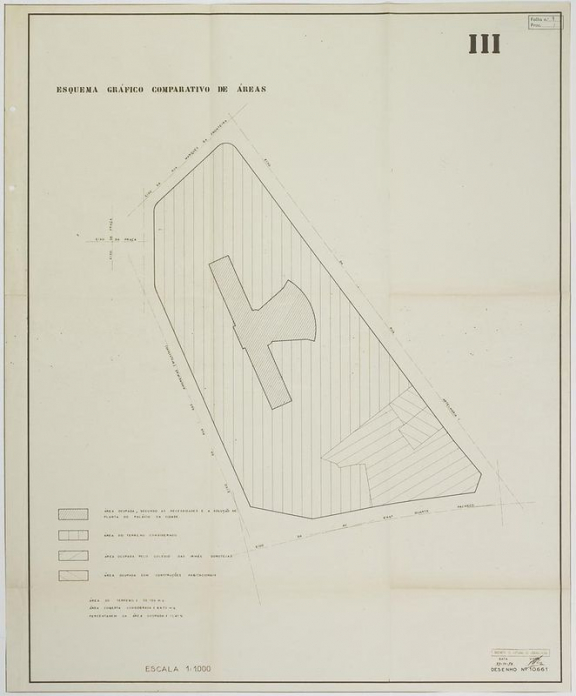
Comparative Chart of Areas I Comparative plans of possible locations for the Foundation’s Headquarters and Museum